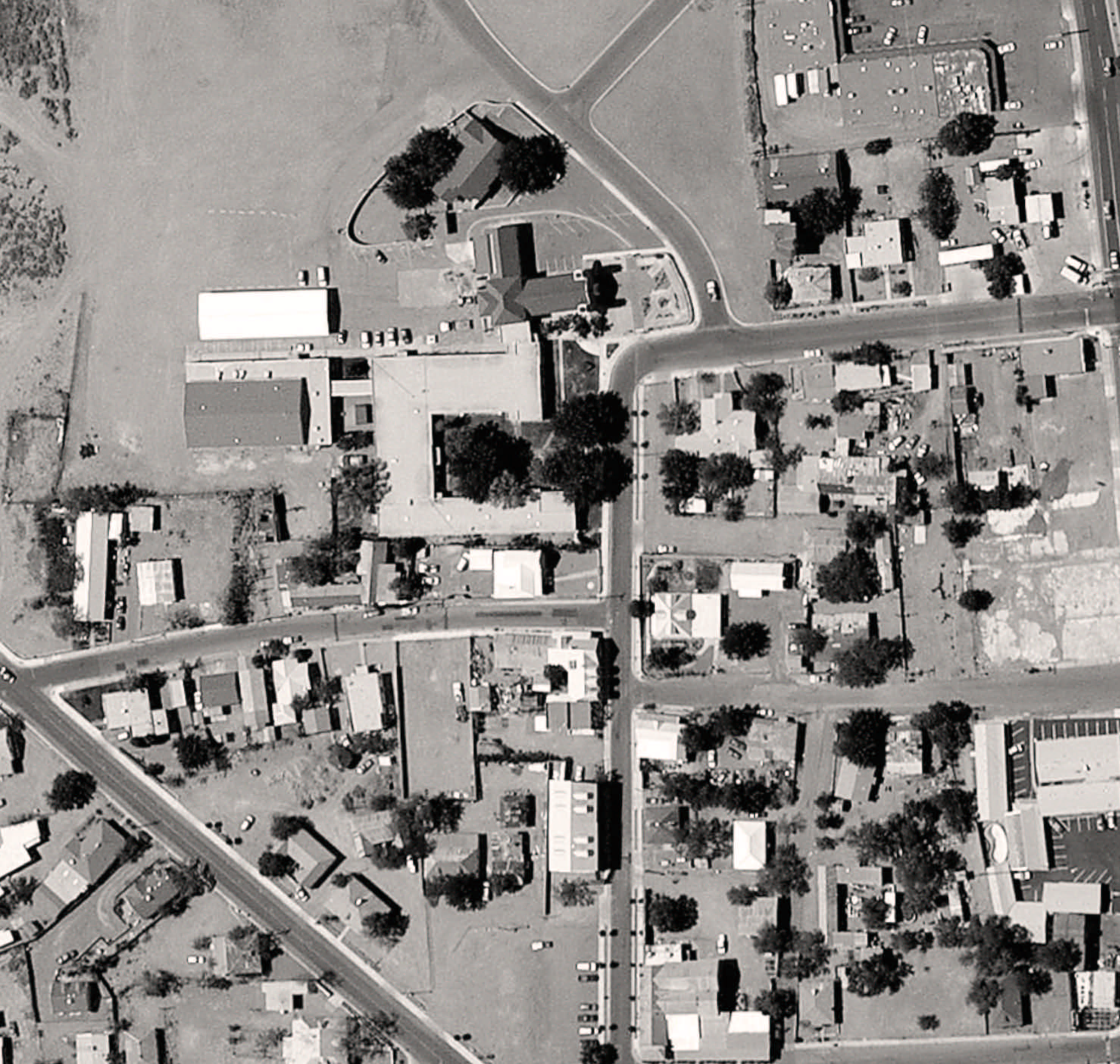
Aerial photo of central Socorro, north of the town plaza. 1) San Miguel Church. 2) Adobe wall and floor found in 2014. 3) Two pre-1680 pit features found in 2013 and 2014. 4) Utility trench profile documented in 2013. 5) San Miguel Parish offices. 6–8) Areas of excavation and auger tests on the southern and western periphery of the San Miguel property. The blue-outlined shape indicates areas of the 2014 GPR survey. Based on archaeological data, the bulk of Pilabó Pueblo was most likely inside the area marked by the broken yellow line. Photograph courtesy of the author.