


By Jayne C. Aubele
We are familiar with the cultural diversity of New Mexico, reflected in its people, history, art, food, and more. But there is another kind of diversity in New Mexico that makes it special: our landscape. And the diversity of our landscape, from mountains to mesas to volcanoes to rivers, is due to the diversity of our geology—our geoscape.
Think about the beautiful landscape of New Mexico: the colorful mesas of Ghost Ranch, the badlands of the Bisti/De-Na-Zin Wilderness, rugged Wheeler Peak, the Valles Caldera and its tent rocks and hot springs, the different profiles of the Sandia Mountains and the Organ Mountains, the cliffs along the Gila River, the amazing Blue Hole near Santa Rosa, Carlsbad Caverns and White Sands National Parks, and Ute Mountain and the “desert peaks” of New Mexico’s two newest national monuments.
Every rock records something about the time and the environment when it was formed. New Mexico’s rocks are time capsules that tell us about the long geologic history of our state, from the oceans to the lowland river plains and the Sahara-like deserts that once covered our state. The landscape tells us about the more recent geologic history; as with the rocks, the landscapes of New Mexico—volcanoes, mountains, mesas, buttes, and rivers—also represent the time period and a geologic process by which they were formed. “Reading the record” of both the rocks and the landscape provides a complete picture of New Mexico’s amazing geodiversity.
1 Rio Grande Rift: The Defining
Feature of New Mexico’s Geology
In New Mexico, the landscape is primarily a result of young, dynamic and, often, still-active geologic processes. One of the reasons why New Mexico is so special is a geologically young and active rift (an area where the Earth’s crust has stretched and thinned) that is located north-south down the center of the state. It is not a plate boundary, it is what is called a continental rift; no other American state has a young, active rift.
You have probably heard of the East African rift; our rift is very similar, and it is one of only five such rifts on the entire planet. The other geologically young continental rifts are Lake Baikal (Russia), the Rhine Valley (Germany), and a rift beneath the ice of Antarctica.
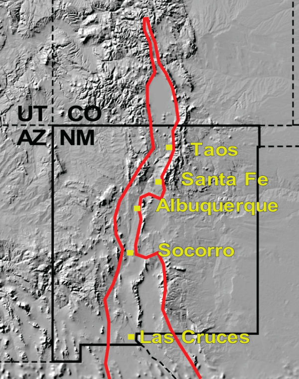
The Rio Grande rift, named after the river that flows down it, began forming about twenty to twenty-five million years ago at the same time that the Basin and Range began to form; both were due to a change in movement along the boundary between the North American plate and the Pacific plate, far to our west. The location of the rift in the middle of our state appears to be the result of the interaction between two physiographic provinces: the Basin and Range Province and the stable and unchanging Colorado Plateau Province. (Figure 1)
Associated with the Rio Grande rift are abundant volcanoes, including the Jemez Mountains/Valles Caldera supervolcano and many more. The rift is a large part of the reason that New Mexico is the Land of Volcanoes. But the rift is also responsible for the north-south mountain ranges running down the center of the state, commonly called the “central mountain chain,” and the rift’s basins or low areas served as a pathway for the Rio Grande. Historically, the rift served as a ready-made route for exploration and trade up and down El Camino Real de la Tierra Adentro; and its flat floodplains and abundant water provided perfect settings for settlement by Native American and colonial territorial agriculture and urban development.
2 New Mexico’s Physiographic
(Geologic) Provinces
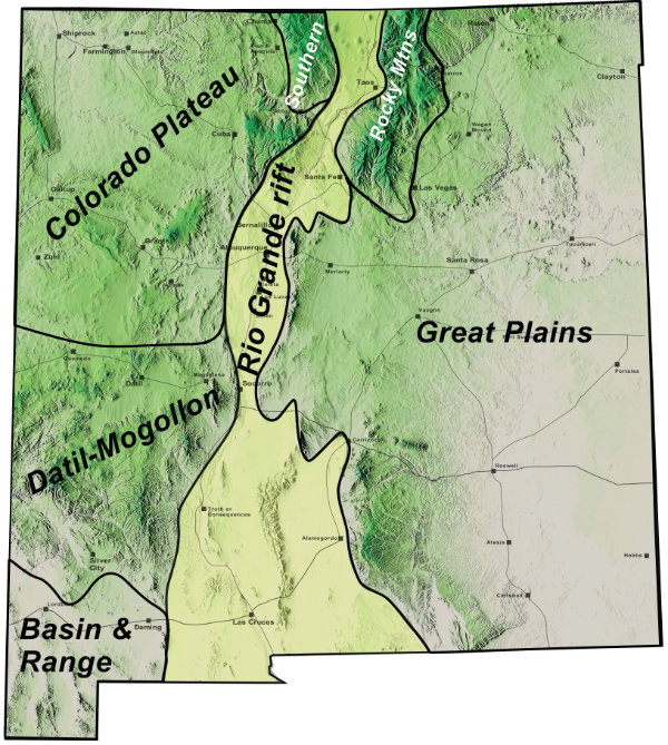
But the rift is just one element in the story of our state’s geodiversity; New Mexico doesn’t stop with just one unique geologic feature. Our state contains the intersection of six major physiographic or geologic provinces—arguably more than any other state. (Figure 2)
The concept of a physiographic province in geology is similar to the concept of ecoregions or biomes in biology. In this case, a physiographic (also called geologic or geographic) province is a region in which all of the landforms within that area are similar in rock type(s), geologic structure, and geologic history.
Each of these provinces has created a landscape that has recorded different times and different events and looks quite different. The geological landscape provides the framework for topography, and therefore life zones; it has influenced the state’s biodiversity, our natural resources, our art and cultural history, where we have settled, and how we make our living in every region of New Mexico.
As you travel throughout New Mexico, you are surrounded by beautiful landscapes that reflect our state’s amazing geodiversity. Let’s take a quick tour to see how this actually looks.
3 Colorado Plateau Province
Northwestern New Mexico
and the Four Corners
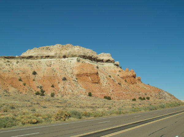
This is the classic landscape of countless Hollywood Western movies. Geologists call it “layer-cake” geology. (Figure 3) Flat-lying rock layers of red, white, and tan sandstone, shale, and limestone have been eroded into mesas, buttes, and sometimes arches or amphitheaters. These rocks were formed during the age of dinosaurs when New Mexico experienced many different environments including rivers, deserts, swamps, and ocean. Subsequently, a few old volcanoes, like Ship Rock, erupted through the flat layers of rock. However, not much else has changed. The Colorado Plateau has remained a stable area of canyons and mesas. It was a place of special meaning to the Ancestral Pueblo people, but resources hidden deep within some of the rocks, such as coal, gas, and uranium have changed our association with this region.
Where to go to see classic Colorado Plateau: Ghost Ranch, Bisti Badlands, Gallup’s Red Rocks, El Morro National Monument, Ship Rock.
4
Datil-Mogollon Highlands
Southwestern and West-Central
New Mexico
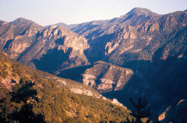
A transition zone of faults lies at the southern margin between the Colorado Plateau and the Datil-Mogollon Highlands, and is the site of abundant young volcanism, including Mount Taylor. However, the Datil-Mogollon Highlands is a region of much older volcanism (Figure 4). This area includes today’s Mogollon, Datil, Black, Socorro, and Magdalena mountains, and these mountains are the eroded and faulted remnants of multiple gigantic caldera eruptions and ash-flows from “super-eruptions,” erupted twenty to forty million years ago.
Where to go to see classic Mogollon Highlands: Gila Wilderness, the nearby Catwalk, City of Rocks State Park, Gila Cliff Dwellings.
5 Basin and Range • Extreme
Southwestern New Mexico
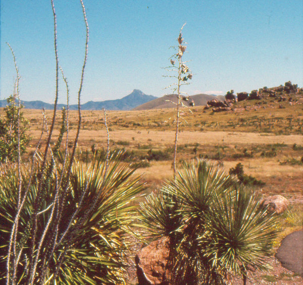
This is a land of parallel mountain ranges and valleys formed by the pulling apart of the North American continent that
began about thirty million years ago. The mountain ranges consist of all ages and types of rock that have been lifted up along faults.
Where to go to see classic Basin and Range: Mimbres Valley, Florida Mountains, Rockhound State Park.
6 Great Plains
Eastern New Mexico
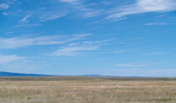
New Mexico’s eastern plains are formed by flat-lying older rocks capped by younger sediment. In the southeast, the flat marine limestone layers, deposited by oceans that existed long before the age of dinosaurs, hide the remains of an ancient marine reef and abundant oil and gas deposits. (Figure 6) Extensive cavern systems and sinkholes began to develop within the ancient marine rocks during the Ice Ages. In the northeast, the flat sandstone, siltstone, and shale layers, deposited during the age of dinosaurs, contain dinosaur footprints. In extreme northeastern New Mexico, the rocks are capped by the easternmost young volcanic field in the continental U.S., the Raton-Clayton Field.
Where to go to see classic Great Plains: Guadalupe Mountains, Carlsbad Caverns, Blackwater Draw between Clovis and Portales, sinkholes such as the Blue Hole near Santa Rosa, Clayton Lake State Park, Capulin Volcano National Monument.
7 Southern Rocky Mountains
North Central New Mexico
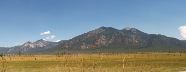
From Raton and Taos south to Santa Fe, the Sangre de Cristo Mountains represent the southern Rocky Mountain Province (Figure 7). In fact, the Sangre de Cristos near Santa Fe are the southernmost true Rocky Mountains; mountains to the south of Santa Fe are either related to the rift or are volcanic. The Rocky Mountains were formed by the folding and faulting of the North American continent at the end of the age of dinosaurs. The rocks within the mountains are even older than the mountains themselves—billions of years old—but the mountains were formed just around sixty-five million years ago and have been shaped and transformed by glaciers within the past few tens of thousands of years.
Where to go to see classic Southern Rocky Mountains: Sangre de Cristo Mountains including the Taos Range, Cimarron, Wheeler Peak, and Pecos Wilderness.
8 Rio Grande Rift
Central New Mexico

The center of New Mexico is dominated by topography and geology associated with the young and still-active Rio Grande rift. The rift is a series of basins with margins defined by young rift-related mountains, like the Sandia Mountains (Figure 8), Fra Cristobal, San Andres, Sacramento, and others, and interiors filled with young volcanism and sediment. The Rio Grande followed the rift’s low valleys to become a major river between one and four million years ago. Most of the central mountains in New Mexico are young mountains related to the development of the rift. The rift has produced much of the landscape of central New Mexico and is responsible for many of its young volcanoes and most of its earthquakes.
Where to go to see classic Rio Grande rift: Taos Plateau, Santa Fe badlands, Fra Cristobal, San Andres, Sacramento, Sandia Mountains.
—
Jayne C. Aubele is a geologist and adult programs educator for the New Mexico Museum of Natural History and Science. She has worked as a field geologist for the U.S. Geological Survey and as a NASA scientist and program manager. Her publications include scientific papers and geologic maps of Earth, Mars, and Venus, geoscience articles/book chapters for the general public, and curricula/materials for teachers of all grade levels. She is past president of the New Mexico Academy of Science and a fellow of the Geological Society of America.